Strategic Noise Mapping of Walloon Infrastructures and Agglomerations
The Walloon Region, competent in environmental matters, is required to apply European Directive 2002/49/EC on the assessment and management of environmental noise.
The Stratec team was commissioned to update the noise cadastre according to the European CNOSSOS method, by modeling and mapping road, rail, and air noise (2022) to assess the exposure of the Walloon population and identify priority action zones.
Location: Walloon Region
Client: Public Service of Wallonia (SPW)
Date: 2022-2023
Partners: ASM Acoustics, Tractebel, Drivenby
Context and Objectives
The European directive has the following objectives:
- to assess noise exposure using harmonised indicators
- to prevent and reduce noise pollution in the most affected areas
- to preserve quiet areas (parks, countryside, etc.)
- and to inform the public about the actions undertaken
The study carried out in this context focuses primarily on assessment and information. The directive stipulates that noise maps should be elaborated every five years according to the CNOSSOS-EU method and distributed free of charge.
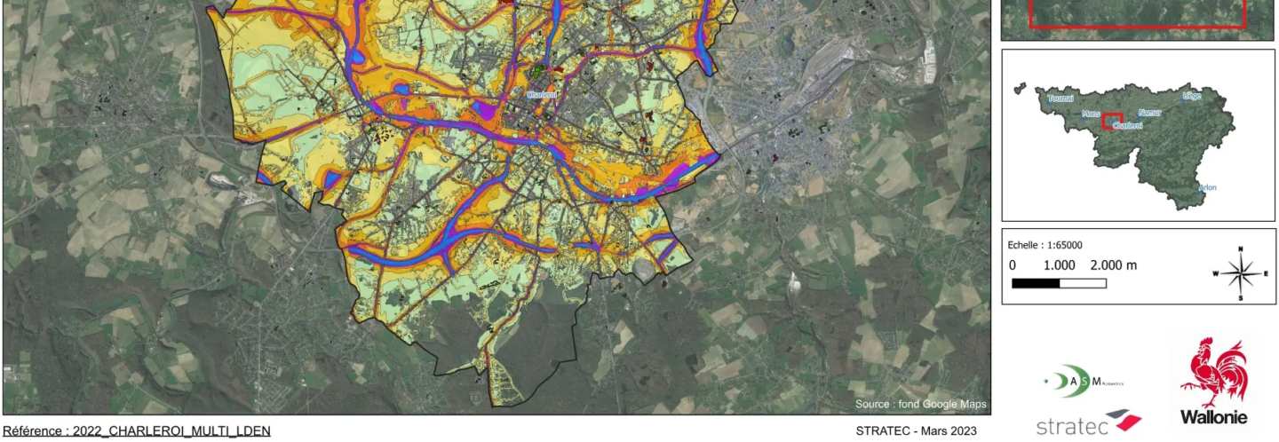
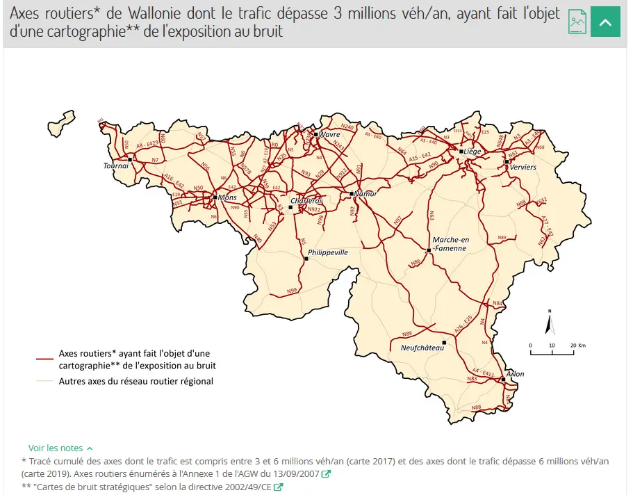
The consortium thus produced an updated and prospective cadastre of transport-related noise pollution. This concerns major road axes (more than 3 million vehicles per year), main railway lines (more than 30,000 annual passages), as well as agglomerations with more than 100,000 inhabitants in Wallonia, namely Liège and Charleroi. The data was mapped and then published according to the requirements of the INSPIRE directive (2007/2/EC).
Photo credit: SPW, 2020
Methodology
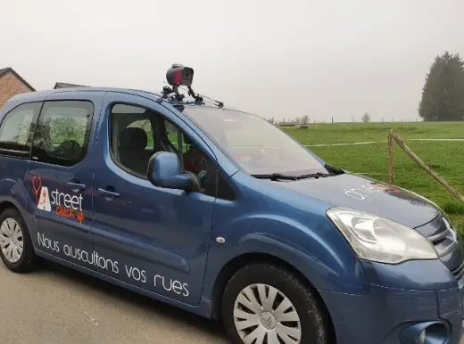
The mission began with the collection and analysis of existing data: networks, topography, buildings, green areas, road traffic, and demographics (including schools and hospitals). This information was supplemented by a mobile-mapping survey of the structural network, specifying the speed, width, and surfacing of the roads. Two traffic models were then developed for Liège and Charleroi.
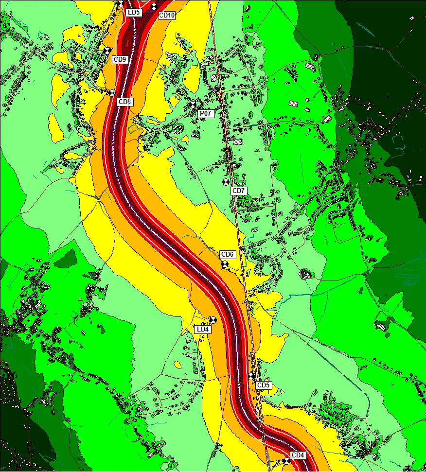
This data allowed for the development of four acoustic models (road axes, railway axes, and each of the two urban centers) according to the CNOSSOS method, using CadnaA software. Their consistency was verified by field acoustic measurements.
Finally, the results were used to produce noise maps, validated by regional stakeholders and integrated into the INSPIRE platform, in accordance with the standards of the European Environment Agency.
Results
The maps and analyses (exposure tables) were integrated into the Walloon Region’s INSPIRE platform (Wallonmap). They now constitute an essential tool for guiding regional noise control actions.
👉 [Consult the noise mapping of the Liège agglomeration]
A methodological report was also drafted. It details the different steps of the mission step by step. In addition, a cartographic atlas gathers all the noise maps (1:10,000 scale) covering all modeled networks.

Contact
Des questions, un besoin spécifique ? Parlez dès maintenant à notre expert
- Batiste Galliez
- b.galliez@stratec.eu
- Directeur d'études
- +32 2 738 78 63